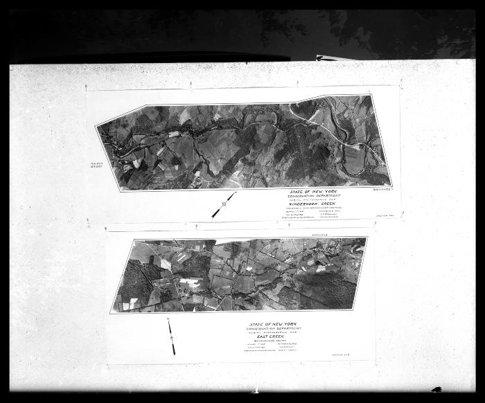
Creeks in Columbia and Rensselaer Counties
Two aerial photographic maps of creeks in Columbia and Rensselaer counties, both dated October 9, 1935. At top is Kinderhook Creek in Columbia and Rensselaer counties, and at bottom is East Creek in Rensselaer County. The scale for both is one foot equals six hundred sixty feet. Both are credited to a Wm. G. Howard, Director of Lands and Forests, and C.S. Robinson, Aerial Surveys. On the Kinderhook Creek map north is to the upper right, and on the East Creek map north is to the upper left. This image was created to record the forestry activities of the New York State Conservation Department.
Identifier
NYSA_14297-87_429
NYSA_14297-87_429
Date Original
October 9 1935
October 9 1935
Contributor
Howard, W.G.; Robinson, C.S.
Howard, W.G.; Robinson, C.S.
Language
English
English
Source
New York State Archives, New York (State). Conservation Dept. Photographic prints and negatives, [ca. 1904-1949], 14297-87, SARA No. 429.
New York State Archives, New York (State). Conservation Dept. Photographic prints and negatives, [ca. 1904-1949], 14297-87, SARA No. 429.
Rights
This image is provided for education and research purposes. Rights may be reserved. Responsibility for securing permissions to distribute, publish, reproduce or other use rest with the user. For additional information see our Copyright and Use Statement
This image is provided for education and research purposes. Rights may be reserved. Responsibility for securing permissions to distribute, publish, reproduce or other use rest with the user. For additional information see our Copyright and Use Statement


