

Champlain Canal Survey, Halfmoon showing Vandenburgh and Clute
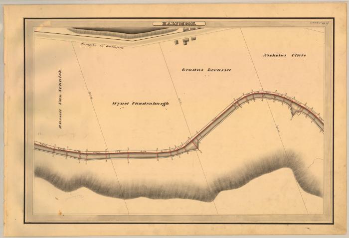
This is an ink, wash and charcoal map of a section of the Champlain Canal in Halfmoon. It shows a small strip of the Hudson River, two small triangle shaped basins, a bridge, six buildings and the Turnpike to Waterford. The red lines indicate courses and distances. The blue lines indicate canal right-of-way. The map also shows the properties of Russell Van Schaick, Wynot Vandenburgh, Gradus Lavassee and Nicholas Clute.
Identifier
NYSA_A0848-77_MC7_DR13_V13_CHAM2_44
NYSA_A0848-77_MC7_DR13_V13_CHAM2_44
Date Original
1830
1830
Language
English
English
Source
New York State Archives, A0848-77, Canal System Survey Maps, 1832-1843, Map no. CHAM2-44
New York State Archives, A0848-77, Canal System Survey Maps, 1832-1843, Map no. CHAM2-44
Rights
This image is provided for education and research purposes. Rights may be reserved. Responsibility for securing permissions to distribute, publish, reproduce or other use rest with the user. For additional information see our Copyright and Use Statement
This image is provided for education and research purposes. Rights may be reserved. Responsibility for securing permissions to distribute, publish, reproduce or other use rest with the user. For additional information see our Copyright and Use Statement
More From This Series
Canal Commissioners canal system survey mapsThe New York State Archives is part of the Office of Cultural Education, an office of the New York State Education Department.
To report technical problems with this web site, please contact the New York State Archives at archinfo@nysed.gov