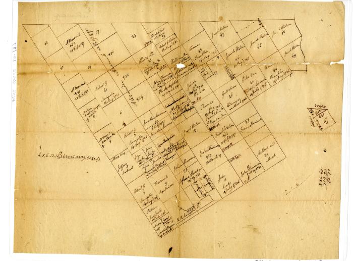
Map of land lots in the Totten and Crossfield Patent, circa 1790s
Map showing lots in the Totten and Crossfield Patent, including those owned by John G. Leake. Each lot on the map was labeled with one or more of the following: owner, lot number, and a date. In addition to Leake, other names of note were Robert Livingston and Jeffery Amherst, as well as others who, like Leake, had their property seized, such as Jacob Watson and Johnathon Lawrence. The reverse side is labeled "Schenectady".
Identifier
NYSA_A4016-77_V10_F137
NYSA_A4016-77_V10_F137
Date Original
circa 1790
circa 1790
Language
English
English
Source
New York State Archives, New York State Engineer and Surveyor. Records of Surveys and Maps of State Lands, 1686-1892. Series A4016-77, Volume 10, Folder 137.
New York State Archives, New York State Engineer and Surveyor. Records of Surveys and Maps of State Lands, 1686-1892. Series A4016-77, Volume 10, Folder 137.
Rights
This image is provided for education and research purposes. Rights may be reserved. Responsibility for securing permissions to distribute, publish, reproduce or other use rest with the user. For additional information see our Copyright and Use Statement
This image is provided for education and research purposes. Rights may be reserved. Responsibility for securing permissions to distribute, publish, reproduce or other use rest with the user. For additional information see our Copyright and Use Statement


