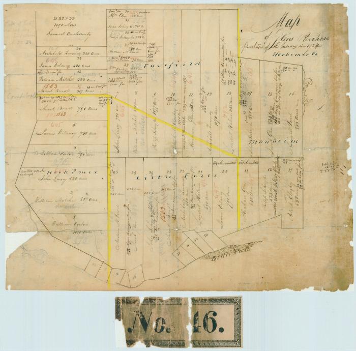
Map of the Glens Purchase, purchased of the Indians in 1734, Herkimer County, N.Y.
Map of the Glens Purchase, purchased of the Indians in 1734, Herkimer County, N.Y. Map of land divided into numbered lots showing acreage and landowners. Map also includes boundary lines between Herkimer, Fairfield, Little Falls, and Manheim, and many survey notes. (Old label in verso of the lining: “No. 46”). Original size 15” x 18”.
Identifier
NYSA_B1610-99_58
NYSA_B1610-99_58
Date Original
1734
1734
Language
English
English
Source
New York State Archives, Series B1610-99, Maps of undivided tracts and of tracts sold by the comptroller for unpaid taxes, [ca. 1700-1935]. Map 58.
New York State Archives, Series B1610-99, Maps of undivided tracts and of tracts sold by the comptroller for unpaid taxes, [ca. 1700-1935]. Map 58.
Rights
This image is provided for education and research purposes. Rights may be reserved. Responsibility for securing permissions to distribute, publish, reproduce or other use rest with the user. For additional information see our Copyright and Use Statement
This image is provided for education and research purposes. Rights may be reserved. Responsibility for securing permissions to distribute, publish, reproduce or other use rest with the user. For additional information see our Copyright and Use Statement


