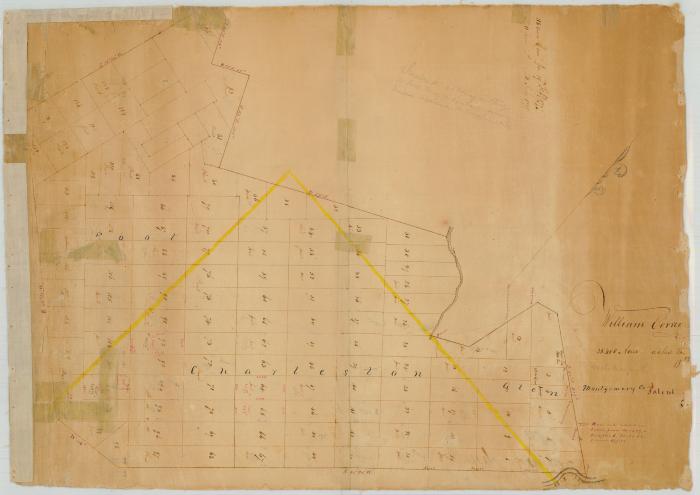
Map of Correy's Patent
Map of Correy's Patent in Montgomery County and Schoharie county. The patent was awarded to William Corry [sic] and others in 1737. The map is composed of paper mounted on a linen backing. Adhesive tape had been used by the State Comptroller's Office to repair the map. This tape has been left in place.
The map was removed from its wooden mounting for scanning. It was placed in a protective polyester (Mylar) folder, so moirés (or Newton’s rings) are present, particularly at the edge of the digital image.
The map was removed from its wooden mounting for scanning. It was placed in a protective polyester (Mylar) folder, so moirés (or Newton’s rings) are present, particularly at the edge of the digital image.
Identifier
NYSA_B1610-99_90
NYSA_B1610-99_90
Date Original
circa 1737
circa 1737
Language
English
English
Source
New York State Archives, New York (State). Comptroller's Office. Maps of undivided tracts and of tracts sold by the comptroller for unpaid taxes, ca. 1700-1935. Series B1610-99, Map 90.
New York State Archives, New York (State). Comptroller's Office. Maps of undivided tracts and of tracts sold by the comptroller for unpaid taxes, ca. 1700-1935. Series B1610-99, Map 90.
Rights
This image is provided for education and research purposes. Rights may be reserved. Responsibility for securing permissions to distribute, publish, reproduce or other use rest with the user. For additional information see our Copyright and Use Statement
This image is provided for education and research purposes. Rights may be reserved. Responsibility for securing permissions to distribute, publish, reproduce or other use rest with the user. For additional information see our Copyright and Use Statement


