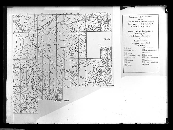
Topographic and timber map of the lands of the MacIntyre Iron Co. Township 45 T and CP
View of a topographic/timber map of lands owned by the MacIntyre Iron Company in Township 45 of the Totten and Crossfield Purchase in Essex County in the Adirondack Mountains. The map may have been drawn by a forester named A.S. Hopkins based on a United States Geological Survey map. This image was likely created to record the forestry activities of the New York State Conservation Commission.
Identifier
NYSA_14297-87_1641
NYSA_14297-87_1641
Date Original
1917
1917
Language
English
English
Source
New York State Archives, New York (State). Conservation Dept. Photographic prints and negatives, [ca. 1904-1949], 14297-87, SARA No. 1641.
New York State Archives, New York (State). Conservation Dept. Photographic prints and negatives, [ca. 1904-1949], 14297-87, SARA No. 1641.
Rights
This image is provided for education and research purposes. Rights may be reserved. Responsibility for securing permissions to distribute, publish, reproduce or other use rest with the user. For additional information see our Copyright and Use Statement
This image is provided for education and research purposes. Rights may be reserved. Responsibility for securing permissions to distribute, publish, reproduce or other use rest with the user. For additional information see our Copyright and Use Statement


