

Survey of land for Henry (Lord) Holland, Holland Patent and Hezekiah Summers. Map #650
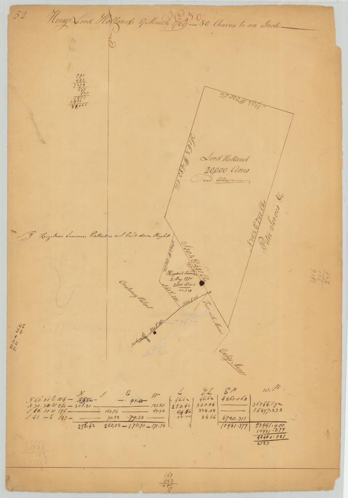
Survey of land for Henry (Lord) Holland, Holland Patent, 20,000 acres; also for Hezekiah Summers, 2,000 acres.
Identifier
NYSA_A0273-78_650
NYSA_A0273-78_650
Date Original
March 17 1769
March 17 1769
Language
English
English
Source
New York State Archives. New York (State). State Engineer and Surveyor. Survey maps of lands in New York State, ca. 1711-1913. Series A0273-78, Map #650.
New York State Archives. New York (State). State Engineer and Surveyor. Survey maps of lands in New York State, ca. 1711-1913. Series A0273-78, Map #650.
Rights
This image is provided for education and research purposes. Rights may be reserved. Responsibility for securing permissions to distribute, publish, reproduce or other use rest with the user. For additional information see our Copyright and Use Statement
This image is provided for education and research purposes. Rights may be reserved. Responsibility for securing permissions to distribute, publish, reproduce or other use rest with the user. For additional information see our Copyright and Use Statement
More From This Series
Survey maps of lands in New York StateGeographic Locations
New YorkThe New York State Archives is part of the Office of Cultural Education, an office of the New York State Education Department.
To report technical problems with this web site, please contact the New York State Archives at archinfo@nysed.gov