

Riverdale Area, N.Y.
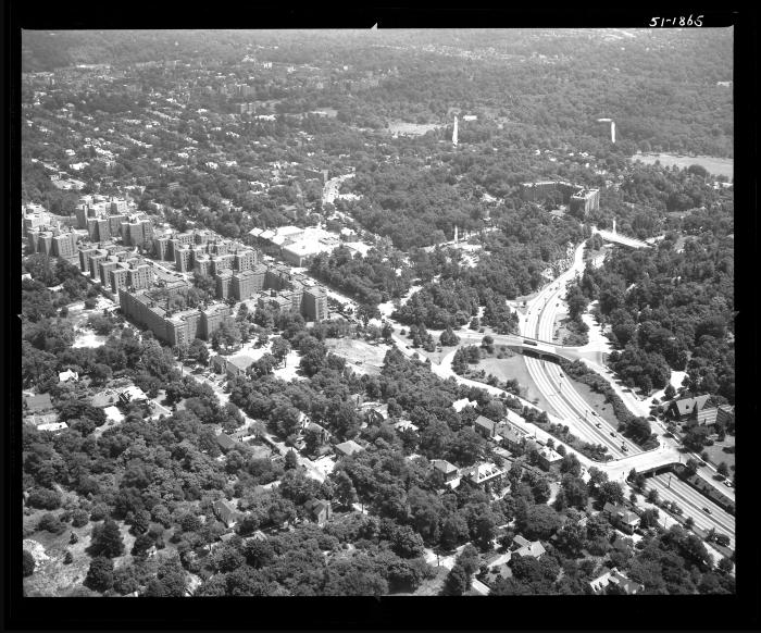
View of the Spuyten Duyvil and King's Bridge sections of the Bronx, New York City about one mile north of the Harlem River, looking northeast. The Henry Hudson Parkway is at the lower right. A large complex of buildings is situated toward the left of the photograph. This photograph is almost identical to image 1866, but is at a slightly larger scale.
Identifier
NYSA_B1598-99_B2F118_51-1865
NYSA_B1598-99_B2F118_51-1865
Date Original
June 22 1951
June 22 1951
Language
English
English
Source
New York State Archives, Aerial photographic prints and negatives of New York State sites, 1941-1957, B1598-99. Box 2, no. 118.
New York State Archives, Aerial photographic prints and negatives of New York State sites, 1941-1957, B1598-99. Box 2, no. 118.
Rights
This image is provided for education and research purposes. Rights may be reserved. Responsibility for securing permissions to distribute, publish, reproduce or other use rest with the user. For additional information see our Copyright and Use Statement
This image is provided for education and research purposes. Rights may be reserved. Responsibility for securing permissions to distribute, publish, reproduce or other use rest with the user. For additional information see our Copyright and Use Statement
More From This Series
Aerial photographic prints and negatives of New York State sitesGeographic Locations
BronxThe New York State Archives is part of the Office of Cultural Education, an office of the New York State Education Department.
To report technical problems with this web site, please contact the New York State Archives at archinfo@nysed.gov