

Downtown, N.Y.
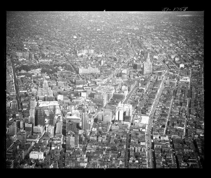
Aerial view of part of downtown Brooklyn, New York. Fort Green Park can be seen in the upper left hand corner of the image bordered by Myrtle Avenue on the left and DeKalb Avenue on the right; Fulton Street may be the street running down the center of the image and Atlantic Avenue the wide street to the right. Several blocks of cityscape including row houses, tall city buildings, streets, public buildings, churches and businesses can be seen. A train line can be seen on the left side of the park.
Identifier
NYSA_B1598-99_B2F101_51-1758
NYSA_B1598-99_B2F101_51-1758
Date Original
June 19 1951
June 19 1951
Language
English
English
Source
New York State Archives, Aerial photographic prints and negatives of New York State sites, 1941-1957, B1598-99 Box 2, Folder 101, Negative Number 51-1758
New York State Archives, Aerial photographic prints and negatives of New York State sites, 1941-1957, B1598-99 Box 2, Folder 101, Negative Number 51-1758
Rights
This image is provided for education and research purposes. Rights may be reserved. Responsibility for securing permissions to distribute, publish, reproduce or other use rest with the user. For additional information see our Copyright and Use Statement
This image is provided for education and research purposes. Rights may be reserved. Responsibility for securing permissions to distribute, publish, reproduce or other use rest with the user. For additional information see our Copyright and Use Statement
More From This Series
Aerial photographic prints and negatives of New York State sitesGeographic Locations
BrooklynThe New York State Archives is part of the Office of Cultural Education, an office of the New York State Education Department.
To report technical problems with this web site, please contact the New York State Archives at archinfo@nysed.gov