

Lower Manhattan, N.Y.
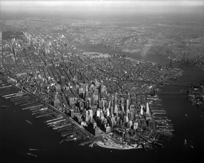
High aerial view of Manhattan Island, New York City focused on the southern tip. The Empire State Building and Central Park are just visible in the distance, and the East River and Queens can be seen to the right.
Identifier
NYSA_B1598-99_101436
NYSA_B1598-99_101436
Date Original
September 30 1947
September 30 1947
Language
English
English
Source
New York State Archives, Aerial photographic prints and negatives of New York State sites, 1941-1957, B1598-99. Box 11, no. 26.
New York State Archives, Aerial photographic prints and negatives of New York State sites, 1941-1957, B1598-99. Box 11, no. 26.
Rights
This image is provided for education and research purposes. Rights may be reserved. Responsibility for securing permissions to distribute, publish, reproduce or other use rest with the user. For additional information see our Copyright and Use Statement
This image is provided for education and research purposes. Rights may be reserved. Responsibility for securing permissions to distribute, publish, reproduce or other use rest with the user. For additional information see our Copyright and Use Statement
More From This Series
Aerial photographic prints and negatives of New York State sitesGeographic Locations
ManhattanThe New York State Archives is part of the Office of Cultural Education, an office of the New York State Education Department.
To report technical problems with this web site, please contact the New York State Archives at archinfo@nysed.gov