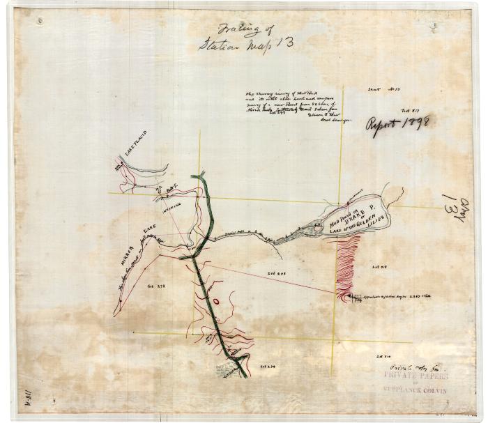
Map Showing Survey of Mud Pond and its Outlet
Hand drawn survey map of Mud Pond and its outlet. This map also shows parts of Mirror Lake and Lake Placid. There is also a survey of a new road from the South East shore of Mirror Lake. The map is marked, "Private copy from private papers of Verplanck Colvin." Original map is 22.5" x 19.5" inches and is held by the Dept. of Environmental Conservation.
Identifier
NYSA_B1405-96_118A13
NYSA_B1405-96_118A13
Date Original
1898
1898
Contributor
Colvin, Verplanck, 1847-1920
Colvin, Verplanck, 1847-1920
Language
English
English
Source
New York State Archives, Dept. of Environmental Conservation, Bureau of Real Property, Verplanck Colvin maps of the Adirondack wilderness
New York State Archives, Dept. of Environmental Conservation, Bureau of Real Property, Verplanck Colvin maps of the Adirondack wilderness
Rights
This image is provided for education and research purposes. Rights may be reserved. Responsibility for securing permissions to distribute, publish, reproduce or other use rest with the user. For additional information see our Copyright and Use Statement
This image is provided for education and research purposes. Rights may be reserved. Responsibility for securing permissions to distribute, publish, reproduce or other use rest with the user. For additional information see our Copyright and Use Statement
Special Project
Environmental History Virtual Resource Collection
Environmental History Virtual Resource Collection


